Did You Know?
None of the original individuals or families who settled in Dublin were from Ireland. Here is a sample of names of early settlers to show the European, and predominant German influence of settlement. Where we know their country of origin, we have included that. We also know name spellings were changed for a variety of reasons; the Sells family, Dublin’s founding family was probably Seltz in Germany. When in Pennsylvania they changed their name to Sells.
From Germany:
Coffman (Kauffman) from Swabia, Germany via Pennsylvania; Datz; Geese from Germany via Pennsylvania; Hirth from Wittenburg, Germany; Horch from Nuremburg and Stuttgart areas of Germany; Karrer from Hoffenheim, province of Baden, in southern Germany; Leppert from Keppenhiem, province of Baden, Germany; Rings, from Germany; Shriver (changed from Schreiber) from Germany via Pennsylvania
From Ireland:
Dominy from Ireland via England; Kilpatrick, Ireland; McCoy, from Ireland via Pennsylvania, moved to Perry Township, Dublin area in 1818
From Italy:
Delewese: name changed from D’Allessandro, from Pettorona sul Gizio, province of Aquila, Italy
Others:
Artz from Pennsylvania; Ashbaugh; Bowers from Pennsylvania; Brown from Maryland; Corbin; Davis: two Davis families; the Samuel Davis family from Connecticut; Ebey from Switzerland (Also spelled Aebi in Switzerland); Freshwater from England; Pinney from England via Connecticut and Worthington to Dublin; Wolpert
A few factors may be in play:
- There already was a German community forming in Columbus, what we know today as German Village
- Land was cheap for hard-working people who wanted to start a new life.
- They were only one generation away from the wars and despotism in their homeland and the new world was total freedom from that in comparison.
- Once one family found the opportunities, they drew others to them; friends and relatives.
The Scioto River provided transportation and at the same time the site was between high limestone bluffs that would prevent flooding the farmland. Large quantities of clay, sand gravel and timber were nearby. These were important building materials. Clean drinking water was plentiful, supplied by at least seven natural springs. The woods were full of game. Tributaries of the Scioto River, what we now call Indian Run and Hayden Run, and several other smaller creeks and ditches provided natural drainage of the land.
The earliest settlers used the rivers the way we use highways and freeways today. The Ohio River and the Scioto River were the direct routes to Dublin.
Many early settlers came from Pennsylvania. From interior Pennsylvania, people found their way to the Youghighany River in the southwestern part of the state. This river flows northwest to Pittsburgh and into the Ohio River. Once on the Ohio, settlers poled their flatboats with all their worldly possessions and, maybe their family, too, to the mouth of the Scioto River. There, they turned north and poled the boat upstream to Franklinton (we know it as Columbus) and as far as they could toward Dublin. Once they could no longer continue by boat, they off-loaded their possessions and walked the rest of the way.
Family histories give us some information of how their ancestors came to America and to Dublin. Here are some examples:
- Lester Leppert’s ancestors came from Germany by sailing ship, a 72-day passage to America.
- Nancy and Basil Brown came west about 1820 from Maryland with their three children and two horses. Adults walked most of the way, letting their children ride the horses.
- George Michael Karrer was born in 1833 in Hoffenheim, Province of Baden in southern Germany. In 1854 with his brother Johanas (John), he sailed in a wooden sailing ship from Germany to New York City, U.S.A., then up the Hudson River by river boat to Albany, N.Y., then by canal boat on the Erie Canal to Buffalo, N.Y., then by boat on Lake Erie to Cleveland, Ohio, and then by horse-drawn canal boat to Columbus, Ohio, where they were met by an Uncle Jacob Horch, who lived near Dublin, Ohio. (from the Karrer family, “Memories”, Dublin Historical Society, 1997)
- Jeremiah Dominy came from Beckmantown, New York, in 1812, in a wagon, with his father-in-law, James Norton.
- Lillian Skeele, writes of her great, great grandfather Robert Kilpatrick in “Memories”. He was born in County Antrim, Ireland, 1785, and was a “red-haired, raw-boned Irishman from Belfast.” He had come to America with the Holland Company or had bought land from the Holland Company and settled in Western Pennsylvania just after the Revolution. He married Jane McKibben and they lived in Meadville, Pennsylvania, before moving to Dublin in 1817.
Zane’s Trace: Another route to the interior of Ohio was Zane’s Trace. It would not have been a direct route to Dublin, but would have lead some settlers into the Ohio Territory from the Wheeling area. In 1796, Ebenezer Zane obtained a commission from Congress to blaze a trail through Ohio to Kentucky. Zane’s Trace began in Wheeling and terminated in Limestone (now Maysville), Kentucky. The Trace followed the present path of U.S. Route 40 from Wheeling to Zanesville then turned southwest toward Lancaster. It connected Chillicothe, then the state capital, Lancaster, Zanesville, and Wheeling, to Maysville. At first it was little more than a trail through the woods, then it was improved to a walking path then a horse path that was slowly improved to a wagon road. Some settlers were able to connect to this road from Pittsburgh to Wheeling, then take this road to the Lancaster area. Zane’s Trace curved southward through Lancaster and did not go through Columbus. Once in the Lancaster area settlers would have to use other trails to Columbus. They could have followed the Hocking River north for part of the way. In 1803 the new Ohio state legislature provided funds to widen and upgrade the Trace.
The National Road, which became U.S. Route 40, did not play much of a role in Dublin’s early development. The Road did not start in Ohio until 1825. It reached Zanesville in 1830, Columbus in 1833, and Springfield in 1838. The eastern stretches of the road coincided with Zane’s Trace, but the roads diverged in the vicinity of Zanesville. This was a road that was being built as they cleared the way, very different from how things are done today.
Yes, ancient cultures called the Hopewells and the Adenas left behind ceremonial mounds still identifiable at one location. Later, the Wyandot tribe, whose primary town was in the vicinity of Upper Sandusky, Ohio, frequented the area we call Dublin as a hunting ground. The river was a route north and south to the Ohio River, which, by canoe or walking path, could lead them to other places.
If you have heard of Tecumseh, Lalawethika, the Prophet (the brother of Tecumseh), Blue Jacket (all Shawnee Indians) these men were alive at the time of the settlement of Sells Town. That will give the history reader an idea of the tension at the time of the settlement here. Other names that readers might hear are Tarhe the Crane and Leatherlips (Shateyoranyah), who both were Wyandots, and Little Turtle and Black Hoof.
The last Wyandots were resettled out of Ohio in 1843 when the U.S. government moved them to reservations in Kansas and Oklahoma. But Bill Moose (Kihue) and his family remained behind, the last full-blooded Wyandots to remain in Ohio.
It will help for the reader to try to think of what the river might have looked like before the dams were built. The water level would have varied depending on rainfall, and people would have known where the shallow points were. These became convenient fords where riders on horseback, buggies, and even wagons might be able to cross the river under the right conditions. One of these fords was approximately where Martin Road would extend across the Scioto River from the east bank to the west bank. There was another in the vicinity of the Hayden Run Road bridge where, before the dams were built, there was a small island in the middle of the river which was part of the crossing. Before a reliable bridge was built, Elisha Hayes operated a crude ferry built with lumber from a single walnut tree he cut from his farm about two miles northwest of Dublin. Because people had to cross the river itself in the riverbed, there were times when people might have had to wait for hours or days on one side or the other before they could cross if the water level was high. That made the coach house and tavern business very good in the village.
Yes, in the early days the sawmills were water-powered and located on the river, but later there was a steam-powered sawmill located near what is now the intersection of Sawmill Road and Route 161.
Linworth is halfway between Worthington and Dublin, and this community, which formerly was named Elmwood, changed its name to Linworth, taking the “Lin” from Dublin and the “Worth” from Worthington!
Deborah A. Black writes in the Horch Family History, in the “Memories” publication of the Dublin Historical Society, 1997, that the intersection of Sawmill Road and Route 161 was known as Tollgate Corner. “In the late 1800’s, some men from Dublin, Elmwood (the early name for Linworth), and Worthington wanted a better road. They formed the Dublin-Worthington Turnpike Company, issued stock and built a hard-surface road. They installed a tollgate at Sawmill road and collected three cents from any person who traveled this road. The exceptions were those persons going to church or a funeral. The road was sold to the county commissioners and became a free road in 1903.”
Early phones were on a local network and were operated with a hand-crank to generate a signal that got the attention of an “operator” who connected the caller with the person being called. Telephone numbers were not needed. Then, the system was more sophisticated, with an electrical-mechanical signal transfer or “exchange” of the signal, not needing a human operator. Dublin numbers were identified with a prefix TU, short for “Tulip” but that was changed to “Tuxedo” when there was some consternation about being identified with a flower. TU on the phone is 88 and many Dublin phone numbers today begin with 889, a carryover from the old TU exchange.
Blocks of ice were cut from the river in the winter and stored in special ice houses, then sold during the summer to put up in the kitchen “ice box”. Straw separated the blocks of ice in the ice houses to keep them from sticking together as they melted.
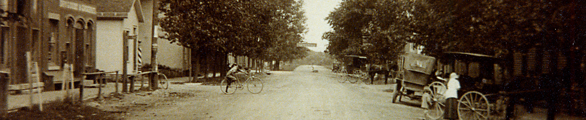
Yes, it was a stagecoach road connecting Greenville, Ohio, and Granville, Ohio. Several buildings that still stand in Dublin were built as hotels for travelers along this route. The building at the corner of Bridge Street and High Street, (today’s Donato’s Pizza) 6 South High Street, built in 1832, was one of these. It was built by John Sells and was once known as the Hutchinson Hotel. Further down South High Street is another, Biddies Coach House, which circa 1890 was operated as the Sells Hotel, a coach house. The Black Horse Tavern, today the property at 105-109 South High Street, an historic, large red frame building built in 1842, was a tavern and hotel.
These were not hotels like we think of them today. Generally, people stayed in one large room and slept on the floor wherever there was space.